Listing Reference #4997 . Listed: 06 Feb 2026
FOR SALE – 4.97 ha (12.28 acres) West Coast Lifestyle Land or Commercial Location near Rapahoe Beach (Whitebaiting Beach) | Easy commute to Greymouth | 1/2h from Punakaiki
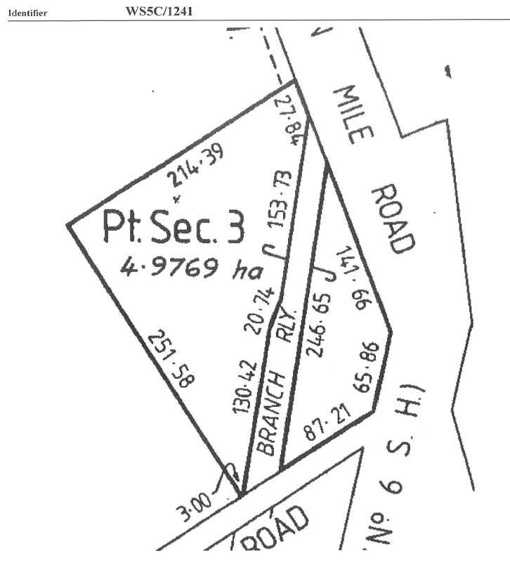
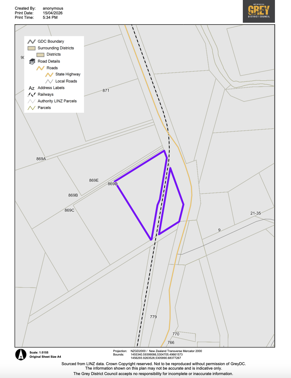
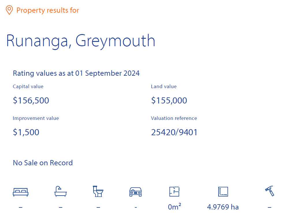
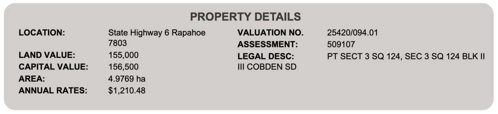
Title number: WS5C/1241
Legal description: Fee Simple, 1/1, Part Section 3 Square 124, 49,769 m2
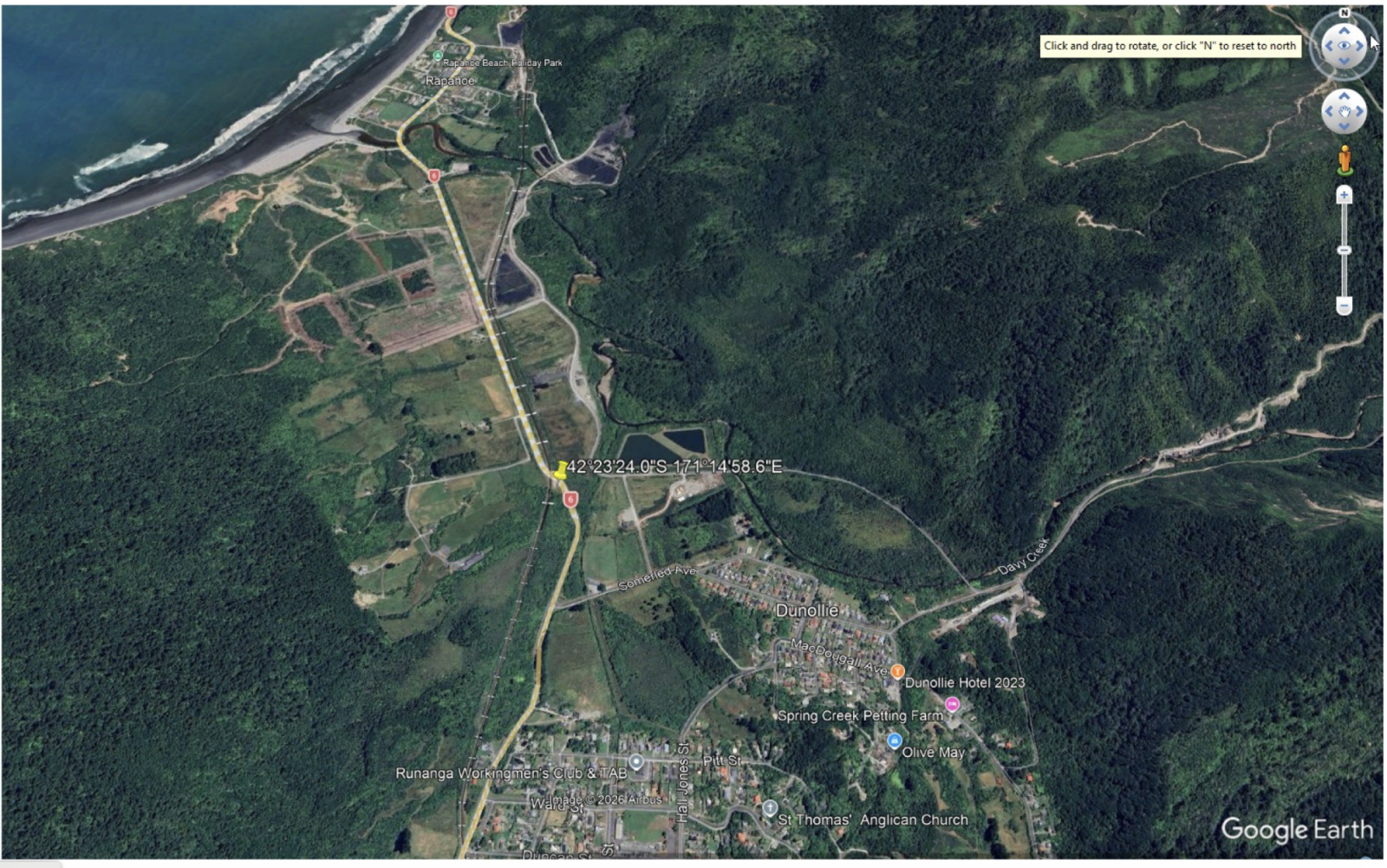
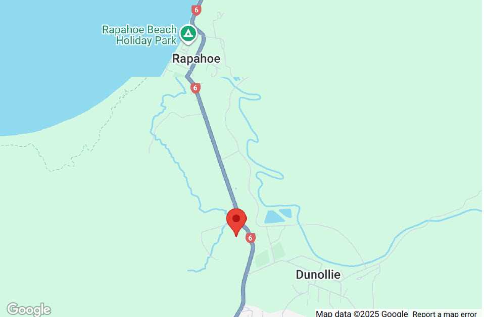
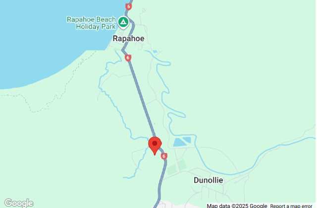
📍 Coordinates: 42°23'24.0"S 171°14'58.6"E
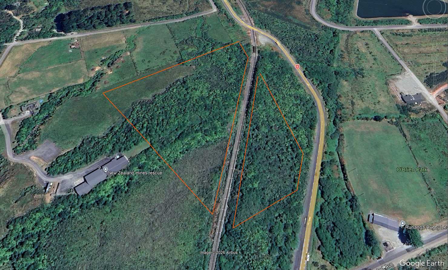
Attractive 4.97 hectares (12.28 acres) of West Coast land, well located between Runanga and Rapahoe, just down the road from Greymouth, with some frontage along Seven Mile Road / State Highway 6.
The land offers an excellent balance of privacy and natural surroundings, making it well suited for a lifestyle block, future residential development, or a low-impact commercial enterprise (subject to council approval).
Location Highlights:
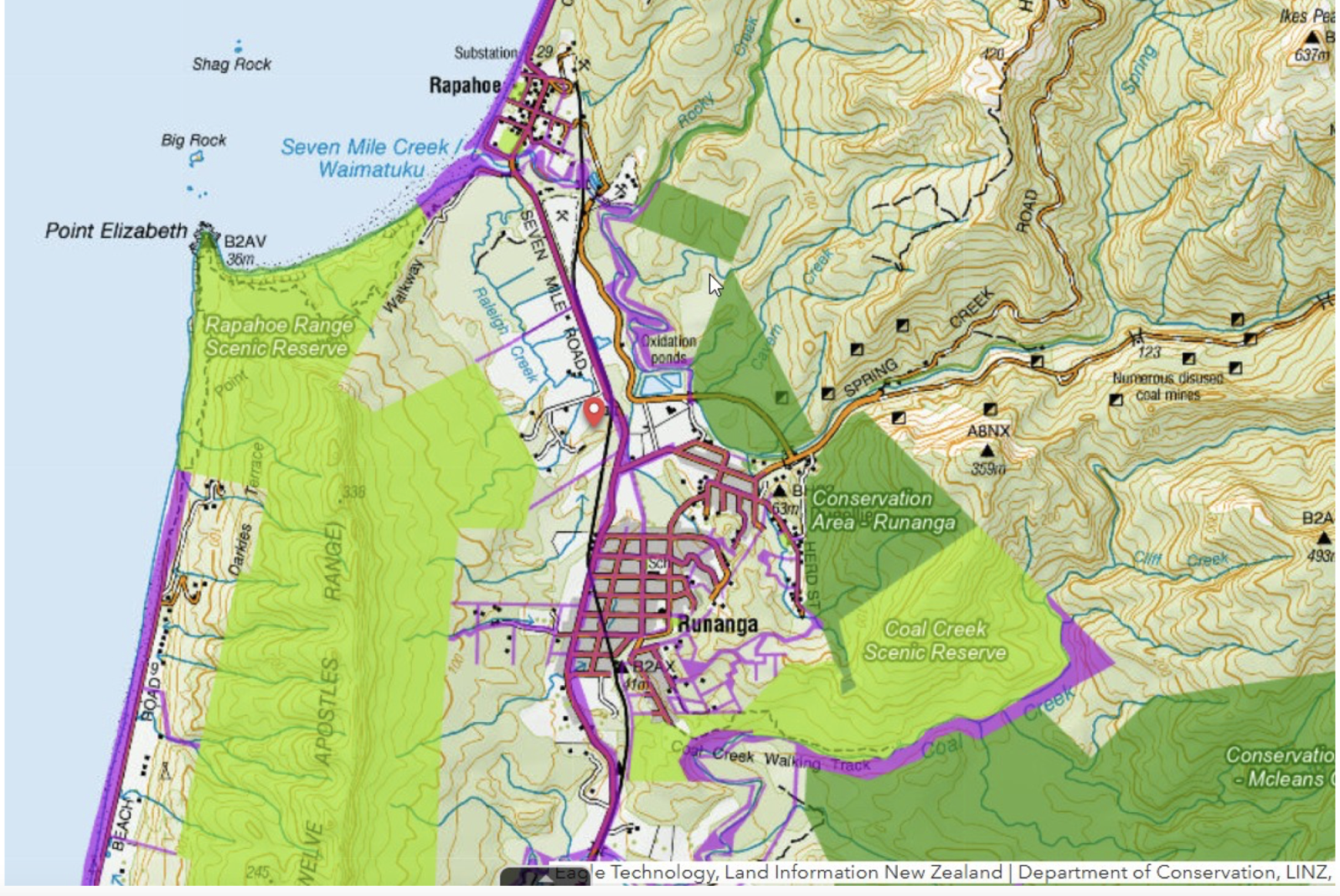
Approx. 11 km from Greymouth town centre, in the locale of Runanga, Dunolie and Rapahoe.
Approx. 2 km from Rapahoe Beach, the South Island’s favourite whitebaiting location.
On the coast side, near the beach, river, bush, walking trails (Point Elizabeth Walkway, Coal Creek Track, etc.) and town amenities.
Land & Features:
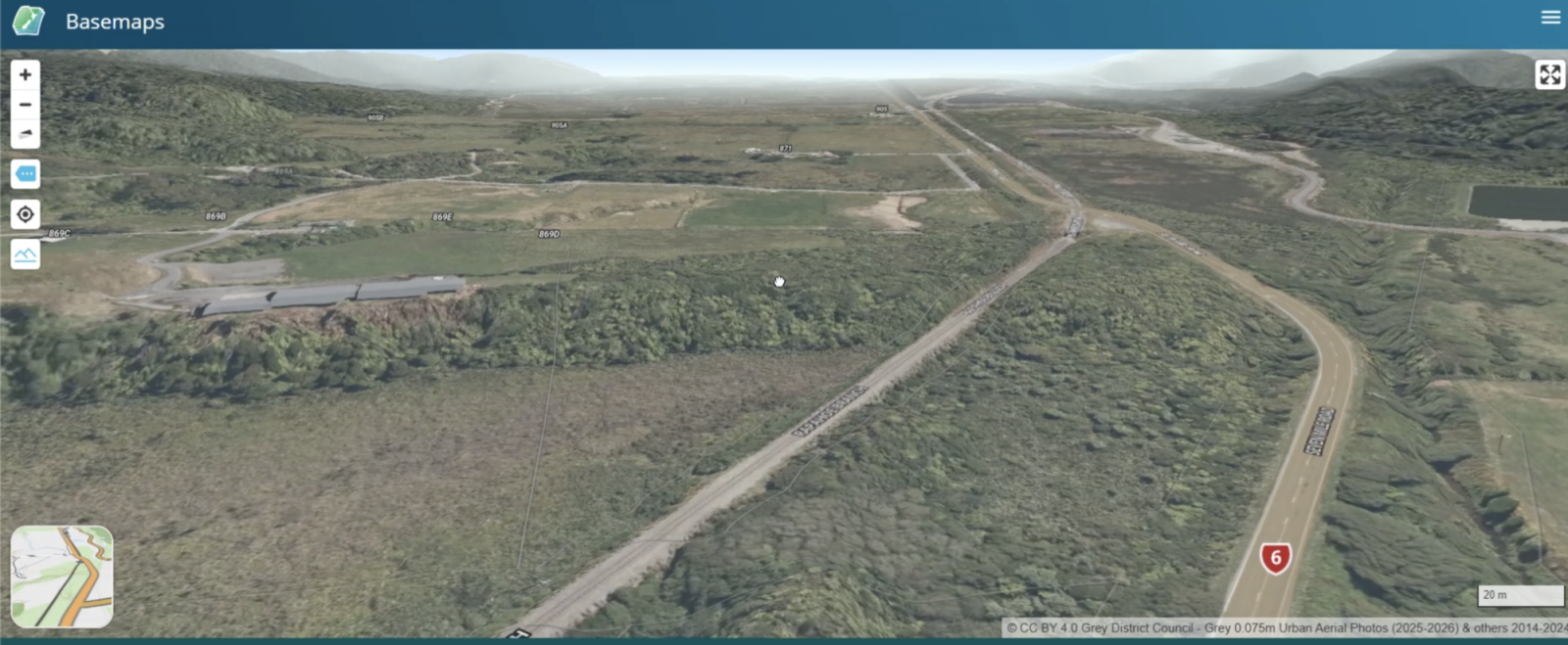
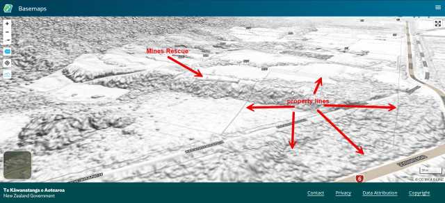
Elevated plateau / hill-elevation suitable for building. This is the same plateau / hill-elevation upon which NZ Mines Rescue Service is built (See 869d State Highway 6, Rapahoe, Greymouth 7803, NZ).
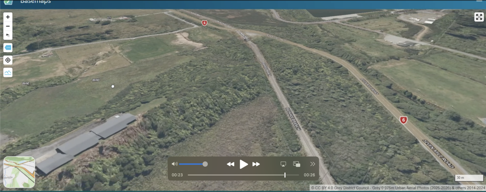
Interact here with the 3D terrain on this beautiful land. The boundaries are lightly visible (in grey). You can rotate, tilt, et cetera to view 360 degrees, the hill-plateau-elevation, the surrounds… and even the sea: https://basemaps.linz.govt.nz/@-42.3915970,171.2476516,z18.41,b-161.2,p66?terrain=LINZ-Terrain&labels=true
Sufficient size and layout to support potential subdivision into 4 large sections (subject to consent).
The portion of land abutting State Highway 6 has potential for a small business, catering to locals / national tourists / international tourists.
Approximately 40% of the lower land consists of marsh / wetland (Raupō swamp), providing ecological value and natural separation
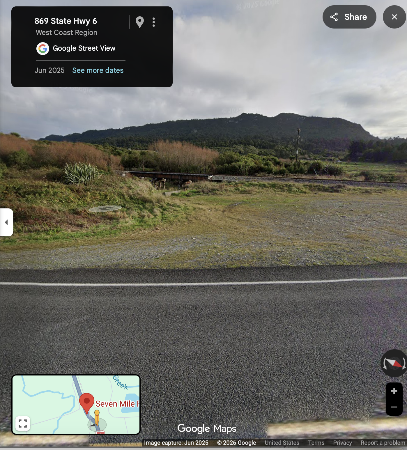
Rail line crosses the frontage portion of the property; one train per day.
Elevated land sits beyond the rail corridor, providing separation from the highway.
Creating access is straightforward as all easements, rights of way (ROW) are in place.
FNMs:
Basemaps_Lay of land, Property Boundaries.jpg (or pdf version)
Rights of Way Diagram_ROW A B C D_AP-411666-1-47-1 DP 2697.pdf
Rights of Way Diagram_ROW FGHIJK_AP-411666-1-46-1 DP 2628.pdf
ROW A F Easement Certs_08343614_MW-411666-1-28-1.pdf
ROW Easement Certs 780024_MW-411666-1-26-1.pdf
ROW F K Easement Certs 08343613_MW-411666-1-27-1 .pdf
Price:
The Capital Value placed on the land is $156,000, but all reasonable offers are considered. Motivated vendor.
Additional Information:
Full legal description, maps, videos, links, pictures and supporting documents available.
Video Link (Highly recommended!): https://drive.google.com/drive/folders/1-x9PCSeZhg9ZN06kDGbtJyC-mIsQC6hC?usp=drive_link
LINZ Link to 3D Terrain (Amazing!): https://basemaps.linz.govt.nz/@-42.3915970,171.2476516,z18.41,b-161.2,p66?terrain=LINZ-Terrain&labels=true
LINZ link to Land Data: https://data.linz.govt.nz/data/category/aerial-photos/?geotag=global%2Foceania%2Fnew-zealand%2Fwest-coast
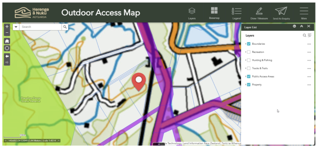
Outdoor Access Map: (User to input “Rapahoe” in search field) https://maps.herengaanuku.govt.nz/Viewer/?map=202d9deb4dfa4c82a13536e12c58d8fa
Grey District Council: https://greydc.spatial.t1cloud.com/spatial/IntraMaps/?configId=2f6f83a4-782b-45eb-9b60-d5819e718428&project=Grey
Self-viewing welcome. — Note there is dense bush and walking boots + eye protection is recommended.
Park safely off the highway and walk onto the land. 📍 Coordinates: 42°23'24.0"S 171°14'58.6"E
Enquiries welcome via email (fiatluxlumiere@gmail.com), include phone number for return call.
Sea views. Native bush.
Some frontage on State Highway 6.
.
.
Clearance of native bush will provide sea views..

Enter a town, city, region or postcode into the search box and we'll show properties in and around that area.